Tag: ancient-civilizations

  • The Evolution of Writing: From Voice to Cloud

    The Evolution of Writing: From Voice to Cloud

    Introduction

    Writing is an important aspect of human life. A typical day of a human’s life generally starts and ends with consuming some form of writing. Writing media has been with us for at least 5,000 years. Whether for business, religious, political, scientific, or literary purposes, writing has either been the proof, the memory, or the assistance for these activities. But the writing medium and instrument were not always the same for all these millennia. In this blog, we dive deep to discuss the evolution of writing across the world and its impact on the civilizations it developed alongside. So, let’s begin.

    Chapter 1: Oral Tradition (Prehistory to Present)

    The earliest form of documentation by humans was obviously the transfer of knowledge orally by recitation and remembrance. Humans have an oral tradition dating back to prehistory of around a hundred thousand years, before the Out of Africa Migration. They used to memorize information based on a certain rhythm, which assisted in remembrance. Oral tradition was generally performed either for storytelling or ritualistic reasons, which later gave birth to both the mythologies and the religious traditions around the world. Oral Tradition is still followed today for less serious information that is considered too vague or casual to be documented in written form.

    Chapter 2: Stone Inscriptions (~3000 BCE to Present)

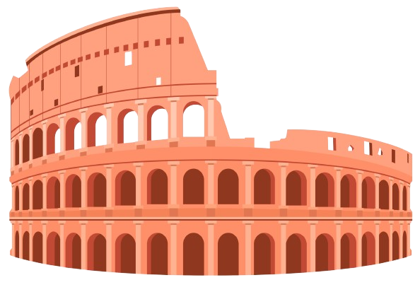
    Around the end of the fourth millennium BCE, humans began to document information in some form of writing. The writing media were large stones or rocks, while the instruments were hammers and chisels. People used to create stone inscriptions depicting information regarding law, statecraft, rituals, etc. Stone inscriptions were also used to depict mesmerizing architectures. The earliest stone inscriptions are found in Mesopotamia and Egypt, which soon spread to other regions like India and China. This invention resulted in the birth of permanent documentation, as the previous Oral Culture was prone to distortion. Although the use of stone for recording information slowly disappeared with time, stones are still used today for architectural decorations, depicting art and culture.

    Chapter 3: Clay Tablets (~3000 BCE to 300 BCE)

    Clay Tablets appeared in ancient Sumer around 3000 BCE. The scribes used a reed stylus, an instrument made of a reed or a bamboo stalk with a cut and split tip to hold ink. They used the stylus on clay tablets to document data about administration, accounting, bureaucracy, and contracts. The use of clay tablets slowly spread to the nearby regions of the whole of Mesopotamia and the Fertile Crescent, and still preserves some of the earliest known documents, including books of the world. The use of clay tablets declined during the Persian control of the region, and fully went extinct after the Greek campaign led by Alexander the Great.

    Chapter 4: Papyrus Scrolls (~2500 BCE to 800 CE)

    While the Mesopotamians were documenting on clay tablets, the Egyptians developed their own medium: Papyrus scrolls. They were an early form of paper made from the pith of the papyrus plant (Cyperus papyrus), and the Egyptians used a stylus with ink to store information on them. The scribes and priests used papyrus scrolls to store various information from commerce to literature to philosophy. Through trade and invasions, the use of papyrus scrolls reached the Mediterranean world and highly impacted the Greco-Roman culture. Their use slowly declined after the use of codices became more prevalent, and they were completely abandoned after the invention and popularity of paper.

    Chapter 5: Palm-Leaf Manuscripts (~700 BCE to 1700 CE)

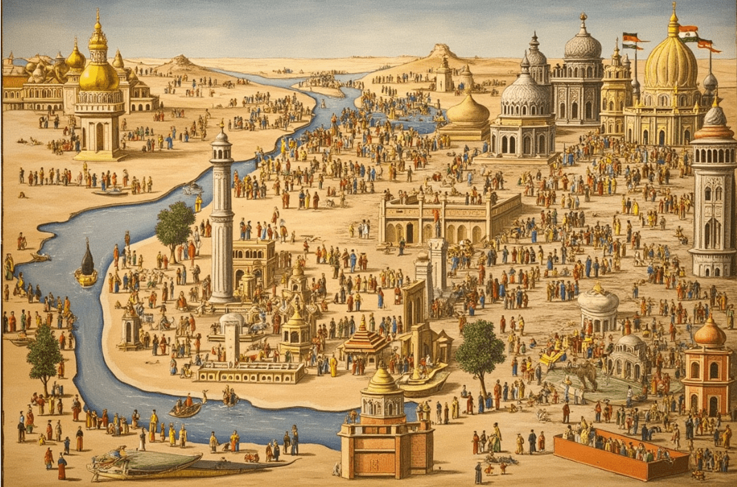
    India has a rich history of oral traditions. When many civilizations began to document in a writing format, the Indians continued their oral culture through precise use of rhymes, syllables, and metres. But around the 10th to 5th century BCE, they began to shift into a form of writing system for the first time. They used a knife or a stylus with ink on palm leaves or bark. Thus, the tradition of palm-leaf manuscripts began. The scholars used the manuscripts to store various information, starting from religious rituals to philosophical and astronomical information. The palm-leaf tradition quickly spread to the rest of the subcontinent as well as to the South East Asia, including Sumatra and Java. It was in palm-leaf manuscripts that most of the documentation of the entire Indosphere was historically recorded. Their use declined after the spread of paper, but continued to be used within traditional lineages till the 17th-18th century.

    Chapter 6: Parchment Codices (~300 BCE to 1500 CE)

    The Greeks, around the Hellenistic period, developed another form of writing medium: parchment or animal skins. The Greek scholars and philosophers used a quill pen and ink on parchment to store information regarding law, metaphysics, philosophy, and science. The medium later spread to other parts of Europe after the Roman colonization of Greece. The use of Parchment Codices reached its peak during the Roman and early Byzantine Periods. They were adopted by early Christianized Europe and continued to be used till the 13th-15th century, but began to be replaced by paper, and were completely out of use by the late 16th century.

    Chapter 7: Paper Manuscripts (~100 CE to present)

    The Paper that we use today was first invented by China during the Han dynasty period, probably around 105 CE. Traditionally, the invention of paper is credited to the Chinese court official and inventor Cai Lun. Imperial China soon began using them with bamboo brushes (baboo handle with animal hair) and inks for literacy, bureaucracy, education, and even trades. Through trades via the Silk Road, the use of paper spread over the Islamic World, from which it reached other civilizations like Africa, Europe,  and India. The invention of paper led to the extinction of other forms of writing, including papyrus, palm-leaf, and parchment, because paper was very cheap, light, and a scalable writing surface. Paper is still used today as the primary form of documentation and records, although it is slowly replaced by digital media.

    Chapter 8: Printed Paper (700 / 1500 CE to present)

    The Earliest forms of printed paper were developed in Tang China around the 7th century CE. They used ink brushed on carved wooden blocks, which were later upgraded to movable parts by the Chinese engineer Bi Sheng in the 1040s. The printers had hundreds of character blocks with water-based inks. The printers soon reached Korea and Japan, creating a writing revolution in the entirety of East Asia.

    Around the 16th century, a German engineer named Johannes Gutenberg created a different type of printing machine, totally different from the Chinese counterpart. It used metal blocks instead of wooden blocks, used limited alphabets instead of hundreds of characters, was relatively faster, and had an oil-based ink instead of a water-based one. The invention of the printing machine helped accelerate the Renaissance in Europe.  It was used for commerce, state-patronage, science, reformation, and many more. Printing presses are still in use as books are mostly (if not always) printed nowadays, although the machine has undergone a tremendous amount of transformation over the centuries.

    Chapter 9: Fountain Pen Writing (1600 CE to 1980s)

    Around the late 16th century, the Middle East developed an early prototype of something which will soon develop into what is known as the fountain pen. The pen had a continuous ink flow, perfect for personal writing and authorship. The prototype reached Europe over the centuries and reached its presentform in the mid 1800s. The fountain pen replaced all other manual writing instruments all around the world and was very popular for more than one hundred years. The fountain pen soon began to lose its importance after the invention of the ballpoint and the gel pen in 1938 and 1984, respectively, and became completely out of use by the 1990s.

    Chapter 10: Typewritten Documents (1870s to 2000s)

    The typewriter, although it had many prototypes in the 1700s, was rarely used till the middle of the 19th century. In the 1860s, an American inventor named Christopher Latham Sholes invented the practical typewriter as we know it today. The instrument could be used for typing a document in a more precise way compared to writing, and soon became an essential part of the industrialized world. The mechanized uniform texts began to be used in governments, corporations, modern offices, and bureaucracies, which is still continued today via computers. Their use began to decline from the 1980s with the beginning of digitalization, and was completely replaced in most governments and corporations by digital documents in the 2000s.

    Chapter 11: Ballpoint & Gel Pen Writing (1938 to present)

    The Ballpoint pen was invented by the Argentine inventor László Bíró in 1938. The pen uses a small rotating ball at the tip of the pen, carrying ink from the reservoirs. The ink is oil-based, resulting in the drying of the writing very fast. The Ballpoint pen had many advantages over the fountain pen: it was low-cost, simpler to use, reliable, and many more. Another type of pen, called the Gel Pen, was invented in Japan in 1984. This pen uses a water-based ink, giving a smoother writing experience, although the drying time is a little longer than that of the ballpoint pen. Both the pens completely replaced the fountain pen and are predominantly in use today.

    Chapter 12: Digital Documents (1980s to present)

    With the development and commercialization of computers and the internet, typewriters faced an existential crisis in the 1980s, as they were soon getting replaced by digital documentation on computers. Further innovations like smartphones, algorithmic memory, AI text, and cloud storage completely ended the lives of typewriters. Today, digital documentation is becoming the dominant form of records and is aiming to completely end the use of paper in human lives.

    Conclusion

    Thus, the storage and documentation of information and data has evolved a long way, from mind to cloud. This blog shows how different civilizations designed their own form of documentation, whether in  Mesopotamia, Egypt, India, China, orthe  Greco-Roman World, before assimilating together to develop an evolved form of storage. The blog also shows the development of the writing instrument: from hammer and chisel to computers, and this journey has been truly wonderful.

    That is all for this blog. Hope you find it informative and educational. Please like, share, and subscribe to my newsletters if you want updates for my posts in the future. Finally, thank you for reading this.


  • India and Iran: A 3000 Year History of Culture, Trade, and Ideas

    India and Iran: A 3000 Year History of Culture, Trade, and Ideas

    A brief comparative study of the relationship between two great cousin civilizations.

    Introduction

    Ancient India and Persia(Iran) were two of the world’s earliest civilizations. From the Indus Valley Civilization to theMaurya & the Gupta Empires and from the Elamite Civilization to the Achaemenid and Sassanian Empires, India and Iran were giants when it came to economy, power & wisdom for about 3000 years. They also shared many similarities between themselves with respect to religion, language, and culture. This blog gives a brief comparative study between the two nations and tries to understand the similarities between the two ancient neighbours and their legacies.

    Linguistic Relationships: A Journey through Vedic Sanskrit and Avestan

    The earliest texts found in the two nations are theVedas and theAvesta. The language through which they are written, i.e., Vedic Sanskrit and Avestan, interestingly shares a good amount of similarities between them. Some of the similarities in their vocabularies are given as follows-

    English WordVedic SanskritAvestan
    Sacrificial RitualYajnaYasna
    Sacrificial DrinkSomaHaoma
    GoldHiranyaZaranya
    Honorable ManAryamanAiryaman
    ArmySenaHaena
    HorseAsvaAspa
    ManNaraNar
    CowGoGav
    EarthBhumiBumi
    AnimalPasuPasu
    MindManasManah
    IsAsAsti
    RiverSindhuHendu/Hindu

    From these words, we can predict that both Vedic Sanskrit and Avestan were perhaps sister languages that may be both descending from a Proto Indo-Iranian Language. Even the people living in both ancient India and Iran referred to their land as Aryavarta and Airyanem Vaejah, both meaning the land of the Aryas or Aryans in  Sanskrit and Avestan. The word Arya means honorable in both languages and has nothing to do with race, unlike that which was adopted and abused by the Nazis. Even the hymns ofthe Vedic Samhitas and the Avestan Gathas sound quite similar when listened carefully during Hindu and Zoroastrian rituals.

    Today the heirs to these languages i.e., Modern Indo Aryan Languages like Hindustani, Bengali, Punjabi, Marathi, Gujarati etc. and Modern Iranian languages like Persian, Pashto, Kurdish, Balochi etc. are spoken in large numbers in countries like India, Pakistan, Bangladesh, Nepal, Sri Lanka, Iran, Afghanistan, Tajikistan and Iraq covering a population of roughly 1,700,000,000 people.

    Indo-Iranian Language

    Religious Relationships: Hinduism & Zoroastrianism- The Parallels & The Antiparallels

    The Ancient Vedic Religion, the precursor to the Hinduism that we know today, was a nature-worshipping polytheistic religion. TheRig Veda- The oldest Indian literature starts with denoting fire or Agni as the priest of Gods as he is considered the purifier of all negatives. He is described as the one leading the Yajna or the sacrificing ritual. A sacrificial drink called Soma was involved with the Yajna consumed during rituals. The Ancient Iranian Religion before the prophet Zarathustra was also a polytheistic religion with its own set of pantheons. Fire was and is always interlinked with Iranian religions and is known byAtar or Atash and is revered as a symbol of purity and truth. Atar represents the divine presence of Ahura Mazda, the chief deity, and is also required for rituals called Yasna and a sacrificial drink called Haoma.

    The deities in the Vedic religion were called the Devas, and the demonic beings were called the Asuras. Chief Vedic Gods include Indra (God of rain, thunder and king of Gods), Agni(God of fire, priest of gods), Varuna(an Asura and God of balance & order, in later stages became God of seas), Vayu(God of wind), Savitr( also calledSurya the sun god), Mitra(God of morning sun, friendship & association, often paired with Varuna), Yama (the God of underworld & justice) etc. 

    The deities in the Ancient Iranian religion were called Ahuras, and the demonic beings were called Daevas. Chief deities include Ahura Mazda(the king of Gods), Mithra(God of rising sun, agreements and contracts), Atar(God of fire and divine purity), Vayu(God of wind), Anahita(Goddess of water & fertility), Rashnu(God of wisdom & justice), Verethragna (God of war & victory).

    Thus, we can see that Ancient Hinduism and Zoroastrianism can be thought of as antiparallel religions in some ways, as the deities in one religion were considered the demons in the other and vice versa ( Deva/Daiva and Asura/Ahura). There is also a similarity in the naming and duties of the deities (Mitra-Mithra, Vayu-Vayu, Indra-Verethragna(both killed a cosmic demonic serpent by the same name Vritra)).

    The later trajectories of the two religions are completely different. Hinduism evolved from a nature worshiping theology to having Gods related to more philosophical concepts gaining more significance ( Vishnu– the protector of life & embodiment of space itself, Shiva– the destroyer of the worlds & the one who controls time, Shakti– representation of cosmic feminine & a source of infinite energy) and even a concept of god with no qualities or attributes (Nirguna Brahman). Zoroastrianism, on the other hand, took a different path- it transformed from polytheism( many gods of equal importance) to henotheism ( Ahura Mazda main god, with all other subordinate gods), to finally monotheism( Ahura Mazda only god, with a negative counterpart, Angra Mainyu, making the philosophy dualistic). In later stages, Persia was conquered by the Muslims of Arabia around 700-800 CE, and thus the religion declined, although many fled to India and are now known as Parsis. India was also conquered by Turkic Muslims around 1300s and European Colonizers around the 1750s, which affected Hinduism a lot, both in philosophy and theology.

    Today, about 1,200,000,000 Hindus live in countries like India, Nepal, Mauritius, Fiji, Guyana, etc., and about 120,000 Zoroastrians live in countries primarily India, Iran, USA, Canada, etc.

    Geographic & Political Relationships: The sacred lands of Indo-Iranians

    The Indian Subcontinent and the Iranian Plateau were the heartlands of two civilizations. The two nations were separated by buffer zones like Bactria(north of Hinukush Mountains, modern-day Northern Afghanistan, Tajikistan & South-Eastern Uzbekistan), Gandhara (modern-day Kandahar region of Afghanistan and Northwest Pakistan, including parts of Punjab), and theIndus River(Parts of Sindh and Balochistan).

    The earliest contact between the two states was around 1000 BCE through businesses and trades in the region of Kabul and Sistan (modern Afghanistan and Balochistan). During the reign of theAchaemenid Emperor Kurush(Cyrus the Great in Greek) around 550-530 BCE, some parts of India came under Persian rule, including Gandhara and Northwest Punjab. Later, Emperor Darayavaus (Darius the Great in Greek) sent an expedition to India. Three of his inscriptions refer to his relations with India, including the Behistun rock inscription (also called Bagastana of place of Gods), dating around 518 BCE, stating Gandhara as one of his subject countries. The Persepolis Inscription includes Punjab under the Persian Empire. The epigraph of Nagsh-i-Rustam shows India as the 24th state of his empire. Nearly one-third of the gold of the Persian Empire was tribute from India. The Achaemenids also bought rice from India to be planted in the Near-East. It is believed that the Greek Mathematician and Philosopher Pythagoras got his doctrine of metapsychosis from India mediated by a Persian. Emperor Khshayarsha(Xerxes I in Greek) took Indians as some of his military units when he invaded and defeated the Greeks.

    Later, after Alexander the Great’s invasion of Persia and India, Persia came under the rule of Seleucus Nicator, one of his generals, thus forming the Seleucid Empire. Emperor Chandragupta Maurya of the Maurya Empire defeated Seleucus and took some territories of Persia under his domain.

    Towards 100 BCE, a group of Indianized Persians called Indo-Parthians or Pahlavas ruled parts of North West India. Both the civilizations benefited from the rise of the Kushan Empire, during which arts like the Gandhara Art and various knowledge systems flourished in Takshashila in India and Jundishapur in Iran, two of the greatest centres of ancient wisdom.

    The Sassanian Empire of Iran and the Gupta Empire of India maintained good relations through trade and commerce. The border lands of Gandhara, Kabul, and Sistan were the melting points of different cultures, knowledge, religions, and other aspects of the world. Mani, a scion of the Ashkanian family in Persia, preached a syncretic religion called Manichaeism, combining beliefs from Christianity, Zoroastrianism & Buddhism, which became a major religion in the Silk Road cities. The Parthians and Eastern Iranians helped in translating Sanskrit texts to Chinese & Tibetan, forming a link between four civilizations.

    After the Islamic Conquests of Iran, many Zoroastrians fled to India via the Arabian Sea. They are said to have landed in Gujarat, which was ruled by the Sisodia clan of the Rajput lineage.

    According to the Shahnameh of Ferdowsi (1100CE), the 5th centurySassanian king Behramgur requested an Indian king, Shangol, to select 12,000 musicians and introduce them to Persia- they are believed to be the ancestors of the Persian Gypsies. The game of Chess is also believed to have been born in India as Chaturanga, evolved in Persia as Shatranj, and finally travelled to the West and became Chess. 

    After the Islamic Conquests, Persia saw a large number of empires like the Great Seljuks, the Ilkhanates, the Safavids, the Afsharids, etc. India also saw great empires during that time, both indigenous and foreign, like the Palas, the Cholas, the Delhi Sultanates, the Mughals, the Marathas, etc. 

    Other important contacts came when the 2nd Mughal Emperor Humayun lost to an Afghan RulerSher Shah Suri, in theBattle of Chausa in 1539. Humayun escaped with family to Persia. The next important contact came when the Afsharid Ruler Nader Shah invaded & looted India in 1738, including the Kohinoor Diamond and the Peacock Throne from the Mughal Court. 

    There were two migrations from Iran to India- one in the 7th-8th century during the Islamic conquests, their descendants are known as Parsis, the other one was from Qajar-Era Iran to British India in the 18th-19th century, their descendants are called Iranis. Both communities had contributed a lot to India’s progress. Important personalities include:

    Homi Jehangir Bhabha(1909-1966)-the father of the Indian Nuclear Programme, Ardeshir Godrej(1868-1936)- co founder of the Godrej Group(along with brother Piroj), Jamsetji Tata(1839-1904)-Founder of the Tata Group, Field Marshal Sam Manekshaw (1914-2008)-Former Indian Chief of Army Staff and the first Indian with the rank of Field Marshal, Dadabhai Naoroji(1825-1917)-Economist, Political Activist & first Asian to be elected to the House of Commons of the United Kingdom (Liberal), first to publicly demand independence for India.

    At present, India and Iran are in their latest avatars, i.e., the Republic of India & the Islamic Republic of Iran, formed on 26th January 1950 & 1st April 1979, respectively. Both the nation-states may be new, but their civilizational souls are over 3000 years old.

    Conclusion

    India and Iran are like two siblings who got lost from each other under various circumstances- Cultural, Political, Geographic, Religious, etc., and now are in their completely own position and going towards their respective ambitions. This blog tries to uphold the civilizational relationships between the two nations and pays homage to the cultural ties across millennia. 

    Suggested Readings-

    Disclosure: This post contains affiliate links. As an Amazon Associate, I earn from qualifying purchases. I only recommend books I truly value.

  • How Ancient Civilizations Measured Time: Archaeoasteonomy and Early Calendars

    How Ancient Civilizations Measured Time: Archaeoasteonomy and Early Calendars

    Time is one of the fundamental quantities of physics and perhaps the most mysterious of them all. I was reading the late Dr. Stephen Hawking’s A Brief History of Time, which inspired me to look into the depths of archaeoastronomy and ancient timekeeping all over the world. I am dedicating this blog to him.

    Introduction

    Archaeoastronomy is the study of how the universe, space, and time were viewed in the past. Timekeeping is the art of recording time using a device or calculations. In this blog, I am writing about the way eight ancient cultures, namely India, China, Egypt, Mesopotamia, Mesoamerica, Greco-Roman World, Celtic/Northern Europe & Islamic World viewed space & time, their cosmology, and their methods of time keeping before the invention of the telescope and the modern clock. How different worlds got inspiration from each other and also their evolution.

    India

    Indian Mandala

    Ancient India was very much inclined to cosmology and timekeeping. According to Hindu Cosmology, time is circular with no beginning or end, but has huge cycles known as Kalpa. A Kalpa is a day of Brahma, the God of Creation, which measures about 4.32 billion earthly years. Brahma’s life spans 100 years, which approximates to 311 trillion earthly years. Each Kalpa is divided into 14 Manvantaras, each lasting 306.72 million years, and each Manvantara is divided into 4 Yugas or ages, which are Satya Yuga, Treta Yuga, Dvapara Yuga, and Kali Yuga. According to Hindu Cosmology, the current Yuga is the Kali Yuga. In Buddhist Tantric Systems, time is also considered cyclical, like Hindu cosmology. The cyclical nature is called Kalachakra, or the Wheel of Time.

    The calendars followed in Ancient India were lunisolar, i.e. combination of lunar cycles and solar years of 365 days. The most common calendars were the Vikram Samvat Calendar from 57 BCE and the Saka Calendar from 78 CE.

    India also had texts on Astronomy & Astrology. The earliest known text on Astronomy & Astrology is the Vedanga Jyotisha from around 1350 BCE. It also includes Geometry and basic Trigonometry. Another later text, which was heavily influenced by the Greeks, is Yavanajataka (Ancient Indians called the Greeks as Yavanas), which was written after the Greeks came into contact with India during  Alexander’s campaign. Another great astronomical text was the Surya Siddhanta, written around 600 CE. In this text, Surya, the Sun God, gives wisdom about astronomy to Maya, the father-in-law of Ravana, the main antagonist of the epic Ramayana. Surya Siddhanta describes gravity a millennium before Sir Isaac Newton and also describes the size and positions of nearby planets quite accurately. It also describes how time passes at different rates under different circumstances and through different perceptions, which can be considered an earlier concept of relativity.

    India also had sites aligned to celestial movements. For example, Junapani stone circles (1500-500 BCE), which were primarily burial sites but also positioned in alignment with the winter solstice sunrise. The Ancient Indians also had their own Prime Meridian passing through Ujjain in modern Madhya Pradesh.

    In early modern India, there were five big observatories built by King Jai Singh II of Amber around the 18th century, called Jantar Mantar. The largest Jantar Mantar is in Jaipur, Rajasthan, which contains the world’s largest sundial.

    China

    Chinese Palace

    Ancient Chinese Cosmology was highly influenced by Daoism. According to it, the world is composed of Yin and Yang, two opposite but complementary forces. Yin, being passive, dark, and feminine, and Yang, being active, bright, and masculine, represent every duality of nature. Together they represent continuous cycles of creation, balance & transformation. The proper symbolization of Yin and Yang was first introduced by the Chinese philosopher Zou Yan in the 3rd Century BCE.

    The Chinese followed  Lunisolar calendars, combining lunar cycles and solar years of 365 days.  They designed their calendars using Sundials & Water clocks, both of which were very much popular in Ancient China. They also developed astronomical charts that depicted stars & constellations. They used lines called skeleton lines, which were used by the government to convey political & cultural values. These star charts were also popular in their sphere of influence, namely Japan, Korea & Vietnam.

    They used Oracle Bones, which were made from Ox shoulder blades or Turtle Shells. The cracks in them were used during the Shang Dynasty (1600-1046 BCE) for divination and to predict Astronomical events.

    China, in later years,s also had a huge number of observatories to study the sky after the influence of post-medieval missionaries. Emperor Kublai Khan also ordered the construction of observatories throughout China.

    Egypt

    Egyptian Pyramids

    The Ancient Egyptians’ cosmology consists of Ra, the Sun Go,d who was also linked to creation by creating the universe and life, and also destruction by destroying chaos. Ra was said to travel through the sky in his Solar Barques: The Mandjet during the day and Mesektet during the night. This journey of Ra in his vessels represented life, birth, and rebirth, thus creating a cosmic order.

    They used mainly a Solar Calendar of 365 days (12 months * 30 days + 5 extra days) for general purposes and also had a lunar calendar for religious and temple contexts.

    The Egyptians relied on the helical rising of  Sirius or Sothis (after 70 days ) to align their civil calendar with astronomical and agricultural cycles. This coincided with the annual flooding of the Nile during mid-July. This also marked the Egyptian New Year. The star was ultimately linked to rebirth & fertility.

    The Egyptians were known for the use of Obelisks for timekeeping. Obelisks were used as sundials and were designed to follow the sun from east to west throughout the day.

    Mesopotamia

    Mesopotamian image

    The Mesopotamians had a Lunisolar Calendar of 354 days; they used metonic systems to adjust the months to 29 or 30 days. The Sumerians also had a Lunar Calendar with 12 months with an average of 29.53 days. They periodically inserted a 13th month to align with the solar year.

    The Mesopotamians had an old history of astronomical observation dating back to 2000 BCE. In star catalogues like the Three Stars Each and also MUL.APIN divided the fixed stars into 3 groups: Anu, Enlil, and Ea, based on where they rose in the Eastern Hemisphere. The stars in the Northern Hemisphere were linked with Anu, the stars in the Equatorial  Region linked with Enlil, and the stars in the Southern Hemisphere with Ea. Anu, Enlil, and Ea were also the three supreme gods of the Mesopotamian Pantheon. Anu was the sky god with the highest importance, Enlil was the god of winds and storms and considered the most powerful of the three, and Ea was the god of water, wisdom, and creation. In a series of 68 to 70 Mesopotamian cuneiform tablets named Enuma Anu Enlil, astronomical and atmospheric events were precisely described, including solar and lunar eclipses, star positions, etc.

    The Mesopotamians also built massive high structures to study astronomy and religious omens, named Ziggurats, which in Akkadian meant “Mountain Peak”.

    Mesoamerica

    Aztec Sun

    The Olmecs were the earliest known Mesoamerican culture that lived between 1500 and 200 BCE. They contributed a lot to astronomy and even mathematics. One such example is the creation of the ritualistic Tzolkin calendar of 260 days (13 months * 20 days).

    The Maya developed a Long Count Calendar to record days from a mythological starting point of August 11, 3114 BCE. It consisted of 5 units: Bak’tun(144000 days), K’atun (7200 days), Tun (360 days), Winal( 20 days) & K’in(1 day), combining numbers 1 to 19 in a positional system to represent dates which would reset after every Bak’tun cycle. For example, December 21, 2012 CE marked the end of one Bak’tun cycle and the beginning of another without a cataclysm.

    They also built pyramids, which were aligned to cardinal directions and celestial events reflecting sacred cosmology comprising both human and divine realms.

    The Mayas used books called codices to record history, pictograms, and celestial representations. About 3-4 codices survive today-

                                  Dresden Codex- deals with astronomy, calendars, and prophecies. The most important codex.

                                  Paris Codex- deals with religious ceremonies, astronomy, constellations & history.

                                  Madrid Codex- tells about Maya gods and rituals associated with them.

                                  The Maya Codex of Mexico, formerly called the Grolier Codex, deals with astrology and predictions.

    The Aztecs used a solar calendar of 365 days named Xiuhpohualli of 18 months of 20 days plus 5 extra days. There also existed a parallel ritual calendar called the Tonalpohualli of 260 days. The two calendars ran simultaneously and together formed a 52-year century known as the calendar round or “xiuhmolpilli’. This marked the renewal of the sun.

    The Aztecs also created a massive basalt structure commonly known as the Aztec Sun Stone around 1427 CE. Also known as the Calendar Stone. It depicted five eras or five suns of the Aztec cosmology. The central figure consisted of a face often identified with the sun god Tonatiuh. Some scholars also argued that the face is of an earth monster named Tlaltecuhtli or a hybrid deity, Yohualtecuhtli, or the Lord of the Night.

    The Greco-Roman World

    Roman Coliseum

    The Greco-Roman world had one of the most advanced systems of astronomy and timekeeping. They primarily followed a lunisolar calendar but were later reformed by Julius Caesar in 46 BCE to a solar calendar, also called the Julian Calendar. Later, under  Emperor Constantine in 336 CE, the Christian Calendar was influenced by the Julian Calendar, like the establishment of Christmas on December 25, coinciding with the solstice and Roman Festivals.

    Ancient Greeks devised an analog computer called the Antikythera Mechanism in order to observe and calculate astronomical positions and events, including the sun, moon, planets, lunar eclipse,s etc. It used intricate gears reflecting advanced knowledge of trigonometry and astronomy.

    Greeks were also early proponents of Heliocentrism. Astronomer Aristarchus of Samos challenged Aristotle’s Geocentric model. Though his ideas were rejected and later totally dismissed by Hipparchus of Nicaea. Hipparchus of Nicaea was a Greek astronomer aroundthe 2nd century BCE who is well known for the discovery of the equinoxes and the gradual shift of the orientation of Earth’s axis, affecting the equinox over time. He estimated the precision rate of about one degree per century, implying a full cycle of approximately 36000 years. He also recorded specific dates of autumnal and vernal equinoxes between 162 and 135 BCE in Egyptian calendar terms.

    Another important astronomer was Claudius Ptolemy of the 2nd Century CE. He preferred the geocentric model and also introduced the concepts of epicircles whose centre moves around larger circles around earth. His system allowed the prediction of celestial motions and eclipses until it was superseded by the heliocentric model. He was also the first cartographer to use latitudes and longitudes.

    The Romans were known to build sundials of various shapes and sizes- even horizontal and vertical. They also developed portable sundials, which can be seen as the ancient wrist watches.

    Celtic/Northern Europe

    Druid Symbol

    The Druids and the Ancient Northern Europeans were known to build huge observatories like the Clava Cairns in Scotland, the Stonehenge in Wiltshire, Southern England, and Ireland’s Boyne Valley. They were used for both as sundials and as observatories. The Stonehenge, a circular ‘henge’ earthwork of about 360 feet in diameter, was built around 3100 BCE. It was primarily a burial pi,t but also acted as a sundial. The Clava Cairns is a Neolithic site where passage graves align with the winter solstice at sunset, illuminating inner chambers at mid-winter.

    The Celtic festivals are closely tied to the seasonal cycles. Main festivals include Samhain (around 31st October/ 1st November) signaling the Celtic New Year and the end of harvest, Imbolc (1st/2nd February) marking the start of spring, Beltane(30th April/ 1st March) celebrating the beginning of summer, Lughnasa(1st August) marking the start of autumn and harvest, Yule during Winter Solstice, Ostara during Spring Equinox, Litha during Summer Solstice and Mabon during Autumn Equinox, completing the annual cycle of the Wheel of the Year.

    They also have the Celtic Cross, featuring a Christian cross and a circle intersecting its arms, representing the sun’s illuminating shining rays behind the cross, blending Christian and Celtic traditions. The design reflects the Celtic reverence for nature and the sun, symbolizing light, life, and spiritual illumination.

    The Islamic World

    Islamic Stars and Moon

    The Islamic world follows a lunar calendar called Hijri of about 354 days with 12 lunar months.

    In medieval times, they were known to use Astrolobe, an ancient astronomical instrument developed aroundthe 6th century CE, used to measure time and the position of celestial bodies by determining their altitude. Though first developed by Europeans, it was refined by the Islamic world.

    During the Islamic Golden Age, most mosques engaged a full-time astronomer called Muqqawil. They were used to find Qibla or the direction towards the Kaaba in Mecca. They were also used to keep the lunar calendar accurate and for studying eclipses, comets, and stellar positions.

    Inthe 10th-11th century CE, a sophisticated method was developed by the Khwarazmian polymath Al-Biruni to measure time using shadows, particularly to develop solar hours and muslim prayer times. His work ‘Shadow’ in 1021 CE details techniques involving gnomonic measurements, the calculation of solar hour angles through the sine of the sun’s altitude, and the use of shadows for various astronomical problems. His shadow-based time measurements integrated trigonometry and astronomical observations with precision and greatly influenced Islamic cartography.

    Short Summary For Each Civilization

    India- saw time as eternal & cosmic- woven through Yugas and Kalpas, a sacred rhythm between the stars and the soul.

    China- measured time in cycles and harmony between Yin and Yang, using calendars for dynastic & administrative purposes.

    Egypt- viewed time as a divine order, ruled by Ra’s daily journey,  anchored in temples through the worship of the sun.

    Mesopotamia- calculated time through mathematics & predictions, recorded through Cuneiform tablets.

    Mesoamerica- honored time as sacred & cyclical, counting not just days but destinies, etched into codices & stones.

    The Greco-Roman World- understood time as rational & observable, through analog computers, geocentric spheres & sundials.

    Celtic/Northern Europe- senses time through seasons- where solstice danced through megalith gates.

    The Islamic World- embraced time with devotion, refining Astrolabes and studying shadows.

    Conclusion

    The concept of time has always kept human beings thinking throughout millennia. Before the invention of telescopes and analog clocks, time and space were viewed entirely differently from what is being considered now. Those views, though only partially accurate, give an understanding of how different ancient cultures perceive time and its structure.

    Suggested Reading

    Explore General Articles on:

    -1. Archaeoastronomy (World History Encyclopedia)

    -2. Ancient Indian Astronomy (World History Encyclopedia)

    -3. Maya Astronomy (World History Encyclopedia)

    -4. Stonehenge (World History Encyclopedia)

    -5. Ancient Calendars and Astronomy (Ancient Origins)

    Recommended Books: A Brief History of Time by Dr. Stephen Hawking, Astrophysics for People in a Hurry by Neil deGrass Tyson.

    Disclosure: This post contains affiliate links. As an Amazon Associate, I earn from qualifying purchases. I only recommend books I truly value.

  • Mapping the Ancient World: How Civilizations Drew the Earth Before GPS

    Mapping the Ancient World: How Civilizations Drew the Earth Before GPS

    Mapping the Ancient World: How Civilizations Drew the Earth Before GPS

    Introduction

    The art of Cartography is more useful than we realise. Maps have become an integrated part of our daily lives. Apps like Google Earth and Google Maps are used by us almost every day, whether we are ordering food, booking vehicles, setting up vacation plans, booking hotels, researching new tourist spots, etc. But that was not always the same. The complete and accurate map of the world is a very new invention in human society. Before that, different regions used to draw maps based on their local understandings, their own rationality, and even their culture. These maps differ from each other in almost every way possible.

    In this post, the cartography from five different regions of the world has been explained: Ancient Mesopotamia (Babylon), Ancient India, Ancient China, the Greco-Roman World, and the Islamic World. Each of the 5 civilizations had its own methodology to describe its worldview. Each Map opens a window to a different but fascinating world.

    1. Babylon- Imago Mundi, The First Map of the World

    The Babylonian Map of the world, also known as Imago Mundi, is a clay tablet made around the 7th century BCE. The Map is written in the Cuneiform writing system popular in the Ancient Near East. The map describes the world as a flat, round disc with the Euphrates River at the center. The city of Babylon is shown along the Euphrates River. Various other cities of different regions are shown, like Susa, the capital of Elam (Ancient Persia) in the south, Urartu (around Ancient Armenia) in the north-east, and Habban, the capital of the Kassites(around the fertile crescent) in the north-west. The map is surrounded by a ring, which signifies “maratum” or bitter river. The other side of the river contains darkness.

    There are texts on both the front and back sides. The text in the front describes the creation of the world by the God Marduk, the chief deity of Babylon, who separated the salted ocean into land and sea. It also describes kings like Utnapishtim, Sargon, and Purushanda. The back side describes various other regions.

    So this map can be considered to be deeply rooted in mythology and creation stories. This is not at all scientific, but it describes a lot about the people and culture of Babylon.

    1. India- Jambudvipa and the sacred landmass

    The ancient cartography of India was strongly influenced by Cosmology(For more on ancient cosmologies, click here). The most famous example is the concept of Jambudvipa found in Hindu, Jain, and Buddhist texts. 

    The Hindu puranas around the 3rd  century BCE, such as Agni Purana, Matsya Purana, Vishnu Purana, and Markandeya Purana describes the world as seven concentric island continents, namely Jambudvipa, Plaksadvipa, Salmalidvipa, Kusadvipa, Krouncadvipa, Sakadvipa, and Pushkaradvipa, with Jambudvipa as the innermost island. These island continents are separated by seven oceans of salt water, sugarcane juice, wine, ghee, yogurt, milk, and fresh water. Markandeya Purana also mentions Jambudvipa to be flattened at the north and the south with an elevated centre where the king of the mountains, Mount Meru, lies, on top of which Lord Brahma, the creator God, resides.

    In Jain cosmology. Jambudvipa is at the centre of Madhyaloka, or the middle world. There are many islands in Madhyaloka. At the centre of Jambudvipa, Mount Meru is situated. These descriptions are found in a Jain text called Jambudipaprajnapti.

    In Buddhist Cosmology, the world is divided into Kamadhatu(Desire realm), Rupadhatu(Form realm), and Arupyadhatu(Formless realm). In Kamadhatu, Mount Meru is located, which is surrounded by four islands; the southern island is called Jambudvipa.

    So from these examples, we see that Ancient Indian Cartography was heavily influenced by Cosmology and resembled more culture and less reality.

    1. Greco-Roman World- Ptolemy’s map, the first map using latitudes and longitudes

    The Ptolemy World Map was the iconic map made in the Greco-Roman world, which used scientific methods for the first time. Claudius Ptolemy, a Greco-Roman astronomer and cartographer, in his book Geographia in the 2nd century CE, introduced the concepts of Latitudes and Longitudes for the first time.

    The continents described are Asia, Europe, and Libya(Africa) with two large seas Mediterranean and the Indian. Geographia consists of 8 books.

    Book 1 describes the theories behind cartography, such as the use of the position of stars to determine directions, using scales, and also Latitudes and Longitudes.

    Book 2 describes Gaul, the Iberian Peninsula, and Central Europe.

    Book 3 describes Italy, Greece, and the regions between

    Book 4 describes North Africa, namely Morocco, Egypt plus Ethiopia

    Book 5 describes Anatolia and the Middle East

    Book 6 describes the Caucasus and Central Asia

    Book 7 describes India, China, and Sri Lanka

    Book 8 describes the maps created for the previously mentioned areas.

    So, in short, Ptolemy’s map was the first scientific map, which revolutionized later cartography.

    1. China- Cartography by Pei-Xiu andthe involvement of politics

    Chinese Cartography, though it had earlier examples, evolved into an iconic form under Pei-Xiu. He was a cartographer in the Three Kingdoms period and later the Jin Dynasty of China around the 3rd century CE. He later became the Minister of Works in the Jin Government. He used surveying, scales, grids, and measured distances to create precise maps. But these maps were meant for the government and the administrators and were not meant for the common folks.

    Later, the Tang(7-10th century CE) and the Song (10-13th century) Dynasties used this technique to map surrounding regions and countries. The maps by Jia Dan during the Tang Dynasty represented Chinese and Non-Chinese territory and presented them to the then-emperor. Though this map is lost, later maps during the Song Dynasty show surrounding regions like Korea and Vietnam. These maps were used by the government to include military, economic, and geostrategic data.

    Thus, these Chinese Maps were less about exploration and knowledge and more about statecraft, nation-building, and strategic surveillance. 

    1. The Islamic World- al-Idrisi and Tabula Rogeriana, the most detailed pre-modern world map

    Muhammad ai-Idrisi was an Arabic geographer and cartographer who lived in the 12th century CE and served the king Roger II of Sicily. He created the Tabula Rogeriana, or The Book of Roger, one of the world’s first detailed atlases. In Arabic, it is known as Nuzhat-al-mushtaq fi ikhtiraq al-afaq, which means The Excursion of One Eager to Penetrate the Distant Horizons. It contains about 70 maps of the known world. His work drew inspiration from the Golden Age of Islam (8th to 13th century CE) during the Abbasid Caliphate. His other inspiration was Ptolemy’s Geographia. This atlas was done with well-researched and used latitudes and longitudes.

    The book was originally written in Arabic, divided into seven climatic zones, each of which has 10 sections. Besides the accuracy and precision, the book had maps with south at the top, which was in accordance to islamic traditions. His maps also described the Islamic World as the centre of influence.

    Thus, this atlas can be said to be a collection of modern maps in a pre-modern world, heavily influenced by Islamic Traditions.

    Summary Table

    Comparative table for ancient maps

    Conclusion

    We have become so used to maps that sometimes we take them for granted and fail to recognize the effort, journey, and stories behind the development of the maps we see now.

    Maps have been a part of human life for the past 3000 years, although the quality, design, accuracy, and purpose of maps have always changed depending on time and place.

    This post thus described 5 such instances of how different maps tell different stories.

    Suggested Reading

    Explore general articles on:

    -1. Maps in Ancient History (World History Encyclopedia)

    -2. Ptolemy’s Geographia (World History Encyclopedia)

    -3. The Babylonian Map of the World (World History Encyclopedia)

    -4. Ancient Mapping Traditions (Ancient Origins)

    Recommended Book: Cosmos by Carl Sagan.

    Disclosure: This post contains affiliate links. As an Amazon Associate, I earn from qualifying purchases. I only recommend books I truly value.